Have you ever been disappointed by the confined angles of your weekly aerial imaging updates collected by helicopter? Have you over- or under-estimated the labor hours and equipment required to excavate an earthworks project? How about finding contractor errors days or weeks after they happen, leading to more and more rework for your project?
The convergence of unmanned aerial vehicle technology; hyper-accurate, location-based, geo-referenced imaging; and 3D scanning technology means big changes for the way you plan and execute construction projects.
3D Imaging
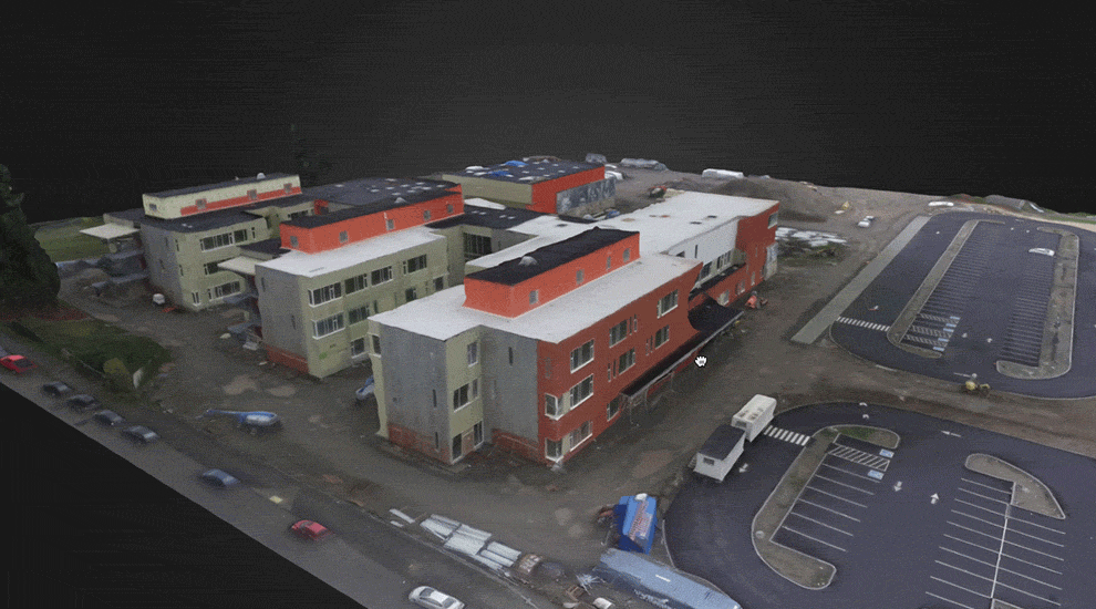
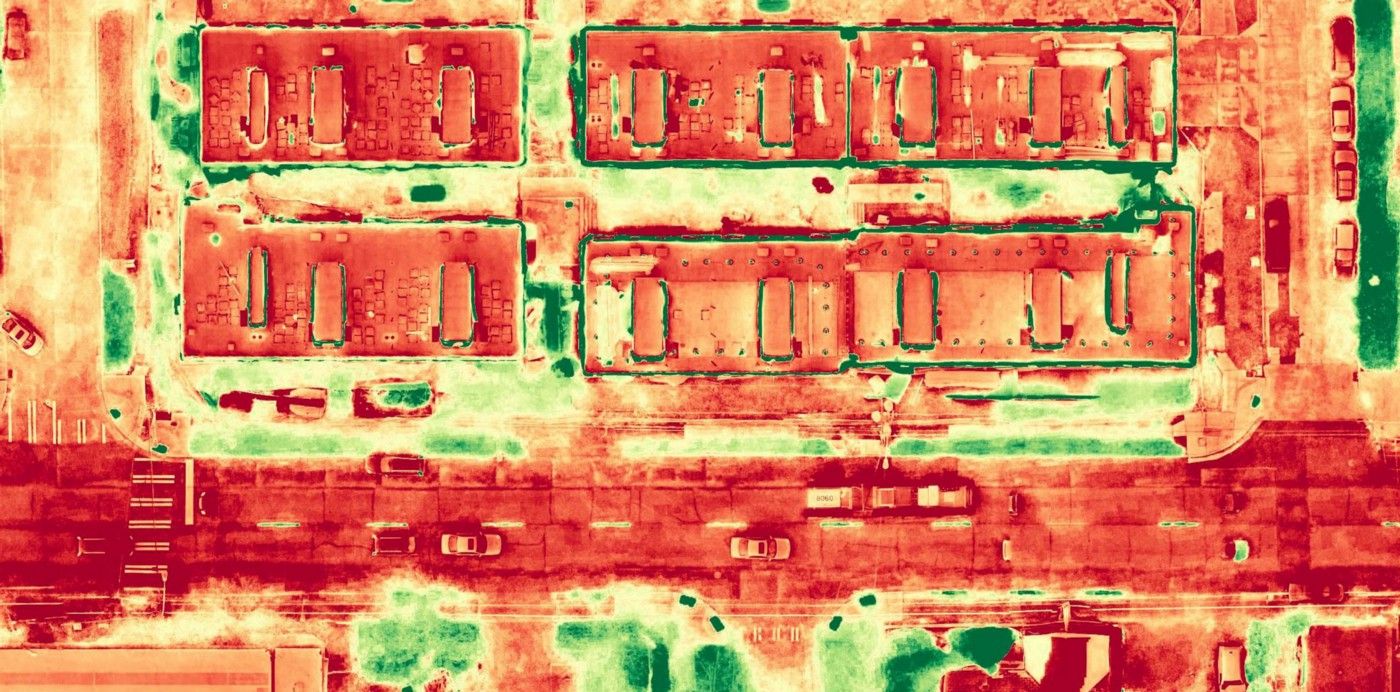
Here’s where you’re really going to save time and money. Using precisely captured, geo-referenced images of your site from all angles, 3D mapping software can stitch these images (usually 400–800) together to create one 3D model of your site on the fly. You can even export these models to AutoCAD for comparison against original designs. When done on a recurring basis, you’ll be able to spot contractor error faster, help reduce rework, and keep on schedule while reducing human risk.
Volumetrics
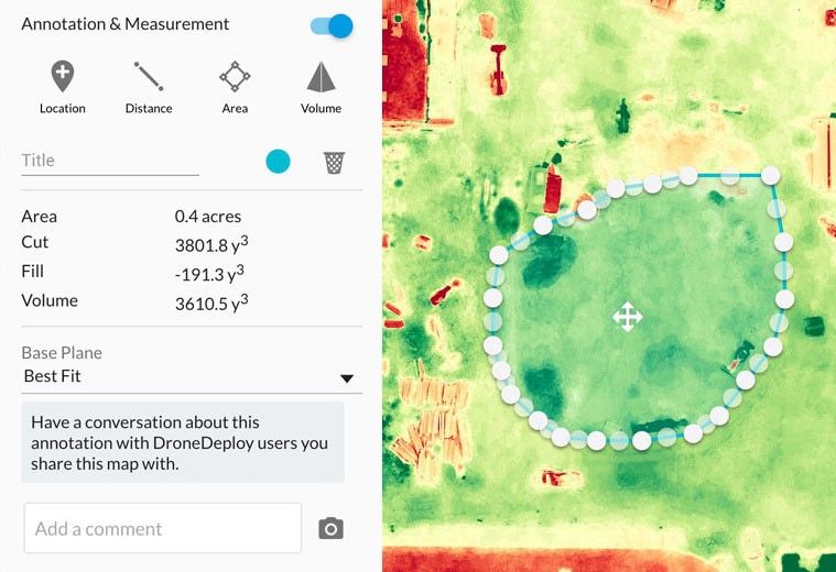
These 3D models can also be invaluable for volumetrics and earthworks projects. Want to determine the volume of a gravel stockpile that will need to be removed? Want to know how many trucks will be needed to do so? Select the area in your interactive 3D map and you’ll get instant volume, cut, fill, and area information determined by your selection.
Construction Progression
You’re probably already getting weekly or monthly aerial images of your site as it progresses, captured by helicopter of fixed-wing aircraft. This has traditionally been a good way to keep an eye on things and inform external stakeholders of progress, but the minimum altitude restrictions leave much to be desired as far as angles and image quality goes. With drone-based imaging, not only can you get imagery of your project from nearly any height or angle you’d like, but you can get extremely high-detailed images to verify structural integrity without sending a human up, reducing your risk. And when it comes to keeping out of town clients up to date, a picture is worth a thousand phone calls.
Corrective Action: Saw overpour back to column footprint.
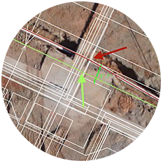
Corrective Action: Fed through the correct sleeve.
Marketing and Design
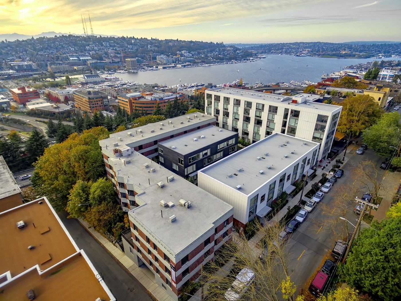
In the planning and design phase, drone technology can capture the precise angles you need for your architectural renderings and site maps. And upon completion, marketing images of your new structure from an aerial view blows traditional ground level imagery out of the water. But this is only the beginning.
Safety
A few things to keep in mind when thinking about adopting a drone data strategy for your project. First, you’re dealing with federal airspace regulations. That means you’ll need to have a federally certified UAV operator, or face fines for each flight (not to mention no insurance policy will cover an unlicensed flight if anything were to happen). Secondly, air traffic is no joke. Your certified UAV operator will know the ins and outs of airspace regulations and conflicts in your specific area, so be prepared if they tell you either flights wont be possible, or additional work is needed to be granted authorization. Standard commercial air traffic in a designated flight pattern is one thing, emergency and news air traffic from hospitals and heliports are quite another. Make sure you’re not flying where you’re not supposed to, and be sure your operator is certified and insured so you don’t expose yourself to additional liability.
Highform can help you develop and implement a drone-data strategy for your construction projects and help you keep on time and under budget. Interested? We’d love to chat.